TOWNSHIPS OF LAND
 
 
Townships are the largest subdivisions of land run out by the United States Surveyors.  In the Governmental Surveys Township Lines are the first to be run, and a Township Corner is established every six miles and marked.  This is called "Townshipping."  After the Township Corners have been carefully located, the Section and Quarter Section Corners are established.  Each Township is six miles square and contains 23,040 acres, or 36 square miles, as near as it is possible to make them.  This, however, is frequently made impossible by:  (1st) the presence of lakes and large streams;  (2nd) by State boundaries not falling exactly on Township Lines;  (3rd) by the convergence of Meridians or curvature of the earth's surface;  and (4th) by inaccurate surveys. 
 
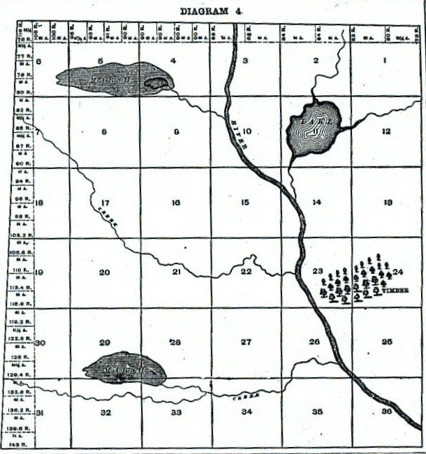
Each Township, unless it is one of the exceptional cases referred to, is divided into 36 squares, which are called Sections.  These Sections are intended to be one mile, or 320 rods, square and contain 640 acres of land.  Sections are numbered consecutively from 1 to 36, as shown on Diagram 4.  Beginning with Section 1 in the Norteast Corner, they run West to 6, then East to 12, then West to 18, and so on, back and forth, until they end with Section 36 in the Southeast Corner. 

Diagram 4 shows a plat of a Township as it is divided and platted by the government surveyors.  These Townships are called Government Townships or Congressional Townships, to distinguish them from Civil Townships or organized Townships, as frequently the lines of organized Townships do not conform to the Goverment Township lines. 


Source: Plat Book of Clinton County, Illinois. Compiled and Published by The Occidental Publishing Company, Geo. A. Ogle &
Company, Proprs., Chicago, 1892 which included the plats and the business directory


  Plat Township Lists
 
Clinton County Genealogy