This compilation Copyrighted by Gloria Dettleff & Dorothy Falk as of 29 May 2003
Updated by Russel & Sandra Bright and Laverne Moody Nov 2008
Updated from Photos by Lucy Buchele May 2010
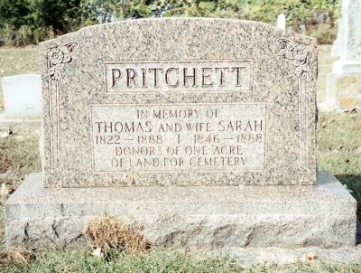
You can reach Pritchett Cemetery by going north on Boulder Road from US Highway 50. Go through the town of Boulder, past the Methodist Church, around the curve for one mile. There is a green road sign that says Pritchett Road and another sign that says Pritchett Cemetery on the right hand side of the road pointing to the road to the left. This cemetery is about .8 mile from the Clark Cemetery Road. Pritchett Cemetery probably belongs to the Boulder Methodist Church. If someone can read their death book and/or cemetery book and update this data base, we will be more than happy to pick up the changes for other researchers.
Section 1 is the older section. Section 2 is the newer section inside the circle drive. Both begin numbering at the back right hand side of the section. The grave number is merely a sequential number of the stones, not of the lots. This number will become obsolete as new burials are made and new stones are installed, especially in Section 2. For a majestic feeling, be sure to stand under the oak tree in Section 1.
History of the cemetery can be found in the Clinton County Historical Society Quarterly 20-2, Page 78.
S/w means shares stone with. GHS means government head stone, PHS means private head stone.

